France Ground Penetrating Radar Market Size, Share & Forecast 2026–2034
Report Highlights
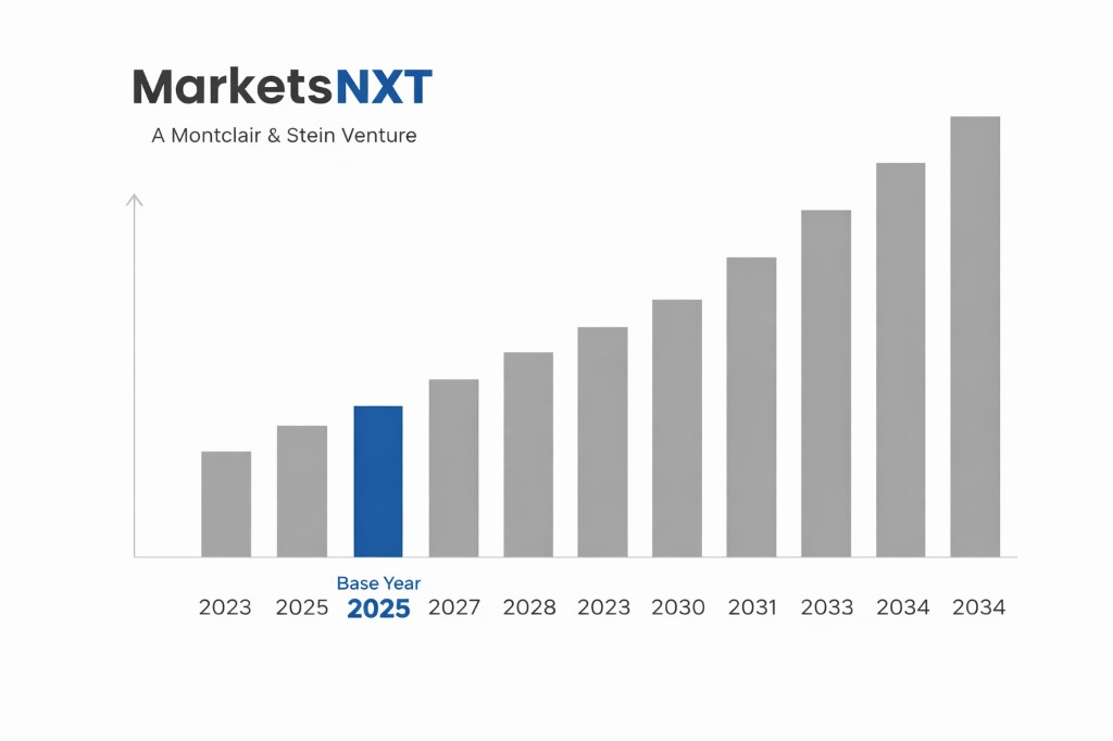
- ✓Market Size 2024: USD 28.5 million
- ✓Market Size 2032: USD 45.2 million
- ✓CAGR: 5.9%
- ✓Market Definition: Ground penetrating radar systems used for subsurface detection and mapping across infrastructure, archaeology, and utility sectors in France
- ✓Leading Companies: GSSI, Sensors & Software, IDS GeoRadar, MALA, Radiodetection
- ✓Base Year: 2025
- ✓Forecast Period: 2026-2032
France Ground Penetrating Radar: Market Overview
France's ground penetrating radar market represents a mature but evolving segment driven primarily by stringent infrastructure maintenance requirements and archaeological protection mandates. The market encompasses approximately 150 active operators, ranging from specialized geophysical survey companies to large construction contractors who have integrated GPR capabilities into their service portfolios. Government agencies including CEREMA (Centre d'études et d'expertise sur les risques, l'environnement, la mobilité et l'aménagement) and regional archaeological services constitute significant demand sources, while private sector adoption spans utilities, telecommunications, and construction industries. The market structure reflects France's centralized approach to infrastructure management, with major projects often requiring compliance with specific technical standards established by AFNOR (Association française de normalisation).
Policy frameworks have fundamentally shaped market development, particularly through the Code du patrimoine which mandates archaeological surveys for construction projects, and the Anti-Endommagement des Réseaux (AER) regulations requiring utility mapping before excavation. These regulatory drivers have created a stable foundation for GPR adoption, though market growth has been constrained by budget limitations in public sector procurement and the technical complexity of equipment operation. The dominance of established European manufacturers reflects procurement preferences for EU-compliant systems, while emerging applications in renewable energy site assessment and smart city initiatives signal potential expansion beyond traditional uses. French operators increasingly favor integrated systems that combine GPR with other geophysical methods to meet comprehensive site investigation requirements.
Policy-Driven Growth in the Ground Penetrating Radar Market
The Loi relative à la transition énergétique pour la croissance verte (Energy Transition for Green Growth Act) has emerged as a primary demand driver, mandating detailed subsurface surveys for renewable energy installations including ground-source heat pumps and solar farms. Under this legislation, administered by the Ministry of Ecological Transition, projects exceeding 20 MW require comprehensive geophysical assessments, with GPR surveys specifically required for installations in sensitive archaeological zones. The associated France Relance recovery plan allocated €100 million for infrastructure digitization, including subsurface mapping initiatives that directly benefit GPR service providers. This policy mechanism translates to market growth through mandatory compliance requirements that cannot be substituted with alternative survey methods, particularly for projects seeking green energy subsidies where environmental impact assessments must include detailed subsurface characterization.
The Anti-Endommagement des Réseaux regulations, enforced by INERIS (Institut national de l'environnement industriel et des risques), mandate utility location surveys before any excavation exceeding 1.5 meters depth, creating consistent demand across construction and infrastructure sectors. These regulations specify GPR as an approved detection method for non-metallic utilities, with compliance timelines requiring surveys within 21 days of excavation permits. Additionally, the Plan France Très Haut Débit (France Very High Speed Broadband Plan) has designated €3.3 billion for fiber optic network expansion, with GPR surveys required for route planning in urban areas to avoid existing infrastructure conflicts. Each policy mechanism creates legally binding demand that transforms from regulatory compliance into direct market revenue, with penalties for non-compliance ranging from €15,000 to €75,000 per incident.
Regulatory Barriers and Compliance Costs
Equipment certification requirements administered by ANFR (Agence nationale des fréquences) impose significant barriers for GPR system deployment, with electromagnetic compatibility testing adding 4-6 months to equipment procurement timelines and costs averaging €25,000 per system certification. The certification process requires demonstration of compliance with ETSI EN 302 066 standards for ultra-wideband devices, with testing conducted at approved facilities in Rennes or Grenoble. Local content requirements under the Code de la commande publique mandate that public sector procurements exceeding €40,000 prioritize EU-manufactured systems, effectively limiting access to lower-cost Asian manufacturers and increasing equipment costs by 15-20%. Environmental assessment requirements for GPR operations in protected natural areas, administered by regional DREAL (Direction régionale de l'environnement, de l'aménagement et du logement) offices, can extend project approval timelines by 2-3 months with additional documentation costs of €8,000-15,000 per assessment.
Professional licensing requirements enforced by the Ordre des géomètres-experts mandate that GPR surveys for legal boundary determination be conducted by certified surveyors, limiting market access for specialized geophysical companies and creating bottlenecks in service delivery. These restrictions particularly impact archaeological applications where surveys must be supervised by archaeologists holding state-issued authorization cards, adding personnel costs and reducing operational flexibility. Price controls on public sector contracts, established through the Code des marchés publics, limit profit margins on government projects to maximum 12% above demonstrated costs, constraining investment in advanced equipment and reducing incentives for technological innovation. The administrative burden of maintaining compliance with these overlapping regulatory requirements adds an estimated €35,000-50,000 annually in administrative costs for medium-sized GPR service providers.
Policy-Created Opportunities in France
The Contrat de Plan État-Région (CPER) 2021-2027 has allocated €1.8 billion for infrastructure modernization, with specific provisions for subsurface utility mapping in smart city initiatives across 50 designated metropolitan areas. This creates substantial procurement opportunities for GPR services, particularly in Paris, Lyon, and Marseille where comprehensive underground infrastructure databases are being developed. The Programme d'investissements d'avenir (PIA4) provides €20 billion for innovation projects, including €300 million specifically designated for digital infrastructure mapping technologies. GPR service providers can access these funds through partnerships with research institutions or technology developers, with successful applicants receiving up to €2 million in project funding. The regulatory framework specifically incentivizes integration of artificial intelligence and machine learning with traditional GPR data processing, creating opportunities for companies developing automated interpretation software.
Archaeological protection policies under the revised Code du patrimoine have expanded mandatory survey requirements to include routine infrastructure maintenance in historic city centers, creating new recurring revenue streams for GPR operators. The Institut national de recherches archéologiques préventives (INRAP) budget increase to €150 million annually has enabled more comprehensive site investigations, with GPR surveys now required for projects as small as 300 square meters in designated archaeological zones. Additionally, the transition to Industry 4.0 manufacturing standards, supported by €650 million in government incentives, requires detailed facility mapping for automated systems installation. This policy creates opportunities for specialized industrial GPR applications, with premium pricing for surveys meeting ISO 14001 environmental management standards. The convergence of these policy initiatives enables GPR service providers to develop integrated service offerings combining archaeological compliance, utility mapping, and industrial site preparation.
Market at a Glance
| Metric | Value |
|---|---|
| Market Size 2024 | USD 28.5 million |
| Market Size 2032 | USD 45.2 million |
| Growth Rate (CAGR) | 5.9% |
| Most Critical Decision Factor | Regulatory compliance and certification requirements |
| Largest Region | Île-de-France |
| Competitive Structure | Fragmented with specialized service providers |
Leading Market Participants
- Geophysical Survey Systems Inc. (GSSI)
- Sensors & Software Inc.
- IDS GeoRadar
- MALA
- Radiodetection
- Utsi Electronics
- US Radar
- Ground Penetrating Radar Systems LLC
- Chemring Detection Systems
- Penetradar Corporation
Regulatory and Policy Environment
The French GPR market operates under the comprehensive regulatory framework established by the Loi relative à l'archéologie préventive and the Code de l'environnement, with primary oversight from the Ministry of Culture and the Ministry of Ecological Transition. ANFR (Agence nationale des fréquences) administers electromagnetic spectrum allocation under EU Directive 2014/53/EU, requiring all GPR systems to operate within designated ultra-wideband frequencies of 1.6-4.4 GHz with power limitations of -14.3 dBm/MHz. Compliance requirements include CE marking, electromagnetic compatibility testing per ETSI EN 302 066, and registration in the national frequency database maintained by ANFR. Key upcoming regulatory changes include implementation of the European Electronic Communications Code by 2025, which will harmonize GPR frequency allocations across EU member states and potentially expand available bandwidth for advanced imaging applications.
Compared to regional peers, France maintains stricter professional licensing requirements and more comprehensive archaeological protection mandates, creating both market barriers and differentiated demand patterns. While Germany allows broader operator certification categories and the UK emphasizes industry self-regulation, France's centralized approach through CEREMA and regional DREAL offices ensures consistent technical standards but increases compliance costs. The regulatory framework significantly exceeds EU minimum requirements, particularly for environmental impact assessments and cultural heritage protection, positioning France as a premium market with higher service standards but reduced price competition. Recent amendments to the Code du patrimoine have extended mandatory archaeological surveys to smaller development projects, expanding the addressable market while maintaining strict operator qualification requirements that limit new market entrants.
Long-Term Policy Outlook for French Ground Penetrating Radar
Expected policy developments through 2032 include implementation of the European Green Deal infrastructure requirements, which will mandate comprehensive subsurface environmental assessments for all major construction projects exceeding €10 million in value. The planned revision of French building codes to incorporate climate resilience standards will require detailed foundation and drainage system mapping, creating new applications for high-resolution GPR systems. Government commitments under the France 2030 investment plan include €2.5 billion for digital infrastructure development, with subsurface utility databases identified as critical smart city components. These policy changes are expected to increase mandatory GPR survey requirements by approximately 40% compared to current levels, while expanding technical specifications to include real-time data integration and automated reporting capabilities.
The convergence of archaeological protection policies with environmental compliance requirements will reshape market demand toward integrated survey approaches combining GPR with other geophysical methods. Planned amendments to the Anti-Endommagement des Réseaux regulations will extend mandatory utility location requirements to all excavations exceeding 0.5 meters depth by 2028, significantly expanding the addressable market particularly in residential and small commercial construction sectors. Additionally, the anticipated implementation of EU-wide standards for critical infrastructure protection will require regular GPR monitoring of transportation and energy networks, creating new recurring revenue opportunities. These policy trajectories indicate a fundamental shift from project-based demand to systematic infrastructure monitoring, potentially doubling the French GPR market size by 2032 while requiring significant technological advancement in automated data processing and interpretation capabilities.
Frequently Asked Questions
Market Segmentation
- Utility Detection
- Archaeological Survey
- Infrastructure Assessment
- Environmental Monitoring
- Geotechnical Investigation
- Forensic Investigation
- Handheld Systems
- Cart-Based Systems
- Vehicle-Mounted Systems
- Array Systems
- Borehole Systems
- Construction Companies
- Government Agencies
- Archaeological Services
- Utility Companies
- Research Institutions
- Environmental Consultants
- Low Frequency (10-100 MHz)
- Medium Frequency (100-500 MHz)
- High Frequency (500-2000 MHz)
- Ultra High Frequency (Above 2000 MHz)
Table of Contents
Research Framework and Methodological Approach
Information
Procurement
Information
Analysis
Market Formulation
& Validation
Overview of Our Research Process
MarketsNXT follows a structured, multi-stage research framework designed to ensure accuracy, reliability, and strategic relevance of every published study. Our methodology integrates globally accepted research standards with industry best practices in data collection, modeling, verification, and insight generation.
1. Data Acquisition Strategy
Robust data collection is the foundation of our analytical process. MarketsNXT employs a layered sourcing model.
- Company annual reports & SEC filings
- Industry association publications
- Technical journals & white papers
- Government databases (World Bank, OECD)
- Paid commercial databases
- KOL Interviews (CEOs, Marketing Heads)
- Surveys with industry participants
- Distributor & supplier discussions
- End-user feedback loops
- Questionnaires for gap analysis
Analytical Modeling and Insight Development
After collection, datasets are processed and interpreted using multiple analytical techniques to identify baseline market values, demand patterns, growth drivers, constraints, and opportunity clusters.
2. Market Estimation Techniques
MarketsNXT applies multiple estimation pathways to strengthen forecast accuracy.
Bottom-up Approach
Aggregating granular demand data from country level to derive global figures.
Top-down Approach
Breaking down the parent industry market to identify the target serviceable market.
Supply Chain Anchored Forecasting
MarketsNXT integrates value chain intelligence into its forecasting structure to ensure commercial realism and operational alignment.
Supply-Side Evaluation
Revenue and capacity estimates are developed through company financial reviews, product portfolio mapping, benchmarking of competitive positioning, and commercialization tracking.
3. Market Engineering & Validation
Market engineering involves the triangulation of data from multiple sources to minimize errors.
Extensive gathering of raw data.
Statistical regression & trend analysis.
Cross-verification with experts.
Publication of market study.
Client-Centric Research Delivery
MarketsNXT positions research delivery as a collaborative engagement rather than a static information transfer. Analysts work with clients to clarify objectives, interpret findings, and connect insights to strategic decisions.