Spain Ground Penetrating Radar Market Size, Share & Forecast 2026–2034
Report Highlights
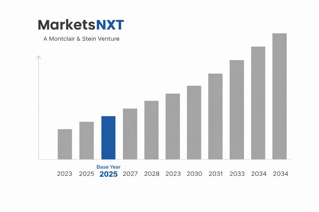
- ✓Market Size 2024: $18.2 million
- ✓Market Size 2032: $31.7 million
- ✓CAGR: 7.1%
- ✓Market Definition: Ground penetrating radar systems used for subsurface detection and mapping across construction, utilities, and archaeological applications in Spain. Technology includes handheld, cart-based, and vehicle-mounted GPR systems for various depth requirements.
- ✓Leading Companies: GSSI, Sensors & Software, IDS GeoRadar, MALA Geoscience, Radiodetection
- ✓Base Year: 2025
- ✓Forecast Period: 2026-2032
Spanish Ground Penetrating Radar: Market Overview
Spain's ground penetrating radar market has experienced steady expansion driven by increasing infrastructure modernization projects and regulatory compliance requirements. The market, valued at $18.2 million in 2024, serves diverse sectors including construction, utilities, transportation, and cultural heritage preservation. Spanish GPR adoption has been particularly strong in urban areas where aging infrastructure requires precise subsurface mapping to avoid utility strikes during excavation. The construction boom in major cities like Madrid, Barcelona, and Valencia has created sustained demand for GPR technology, while archaeological preservation mandates have established specialized market segments for heritage site investigation.
Market structure reflects a combination of international technology providers and specialized local service companies. While equipment manufacturing remains dominated by foreign suppliers, Spanish firms have developed expertise in GPR services and consulting, particularly for archaeological applications where Spain's rich cultural heritage creates unique requirements. The market has evolved from basic utility location services to sophisticated applications including bridge deck assessment, tunnel inspection, and environmental monitoring. Government infrastructure investments through the Plan de Recuperación, Transformación y Resiliencia have accelerated demand for advanced subsurface investigation technologies across multiple sectors.
Policy-Driven Growth in the Spanish GPR Market
The Spanish government's infrastructure modernization initiatives have created substantial policy-driven demand for ground penetrating radar technology. The Plan de Recuperación, Transformación y Resiliencia, with €69.5 billion in EU recovery funds through 2026, specifically allocates €6.8 billion for transport infrastructure and €6.4 billion for urban regeneration projects requiring comprehensive subsurface investigation. These programs mandate non-destructive testing methods for infrastructure assessment, directly boosting GPR utilization. Additionally, the Real Decreto 513/2017 governing excavation safety requires subsurface utility mapping before major construction projects, creating mandatory demand for GPR services in urban areas where underground infrastructure density is high.
Archaeological protection legislation, particularly the Ley 16/1985 del Patrimonio Histórico Español and regional cultural heritage laws, mandates GPR surveys before construction in historically sensitive areas. This requirement has generated consistent demand for specialized GPR applications, with archaeological surveys representing approximately 15% of the Spanish GPR market. The Código Técnico de la Edificación requires subsurface investigation for certain building types, while municipal regulations in major cities increasingly specify GPR use for utility location before excavation permits are granted. These policy mechanisms translate into market growth by creating both mandatory and recommended use cases across construction, infrastructure, and heritage sectors.
Regulatory Barriers and Compliance Costs
Spanish GPR operators face significant regulatory complexity through overlapping jurisdictions between national, regional, and municipal authorities. The Ministerio de Transportes, Movilidad y Agenda Urbana oversees infrastructure-related GPR applications, while the Ministerio de Cultura y Deporte regulates archaeological uses, creating dual approval pathways for heritage site investigations. Professional certification requirements vary by region, with some autonomous communities requiring specialized training credentials that add 6-12 months to operator qualification timelines. Environmental impact assessments, mandated by Real Decreto 1131/1988, can delay GPR projects by 2-4 months when surveys intersect protected areas or water resources, particularly affecting coastal and mountainous regions where environmental sensitivity is high.
Import regulations for GPR equipment involve complex CE marking requirements and radio frequency authorization through the Secretaría de Estado de Telecomunicaciones e Infraestructuras Digitales, adding €3,000-8,000 in compliance costs per system. Local content requirements for public infrastructure projects, established under various regional procurement regulations, limit equipment choices and increase costs by 15-25% compared to international alternatives. Insurance and liability requirements for subsurface investigation services have increased substantially, with professional indemnity coverage now requiring €500,000-2 million minimum coverage depending on project scope, adding significant operating costs for smaller GPR service providers and creating market consolidation pressure.
Policy-Created Opportunities in Spain
The Spanish government's Plan Nacional Integrado de Energía y Clima 2021-2030 allocates €241 billion for renewable energy infrastructure, creating substantial opportunities for GPR applications in solar farm development, wind turbine foundation assessment, and electrical grid modernization. Specific opportunities include the Red Eléctrica de España's €6.8 billion grid expansion program requiring extensive subsurface investigation for new transmission lines. The Plan de Infraestructuras de Transporte y Vivienda includes €25 billion for railway modernization through 2030, with high-speed rail extensions requiring comprehensive geological and utility mapping using GPR technology for route optimization and construction planning.
Smart city initiatives across major Spanish municipalities create emerging opportunities for continuous infrastructure monitoring using automated GPR systems. Barcelona's Smart City Plan 2017-2020 continuation and Madrid's Estrategia de Sostenibilidad Ambiental both include provisions for advanced underground infrastructure mapping to support urban resilience planning. The Estrategia Nacional contra la Pobreza Energética includes €100 million annually for building renovation programs requiring subsurface investigation before energy efficiency upgrades. Archaeological tourism promotion through regional development funds creates opportunities for GPR-based heritage site investigation and virtual archaeology applications, particularly in regions like Andalusia and Castilla y León where cultural tourism drives economic development.
Market at a Glance
| Metric | Value |
|---|---|
| Market Size 2024 | $18.2 million |
| Market Size 2032 | $31.7 million |
| Growth Rate (CAGR) | 7.1% |
| Most Critical Decision Factor | Regulatory compliance requirements |
| Largest Region | Madrid metropolitan area |
| Competitive Structure | Fragmented with international suppliers |
Leading Market Participants
- GSSI (Geophysical Survey Systems)
- Sensors & Software
- IDS GeoRadar
- MALA Geoscience
- Radiodetection
- Proceq
- Utsi Electronics
- Geometrics
- Leica Geosystems
- Ground Penetrating Radar Systems
Regulatory and Policy Environment
Spain's GPR regulatory framework operates under the Ley 9/2014 General de Telecomunicaciones, administered by the Comisión Nacional de los Mercados y la Competencia (CNMC), which governs radio frequency emissions and equipment certification for ground penetrating radar systems. The Real Decreto 1066/2001 establishes technical requirements for electromagnetic compatibility, while archaeological applications fall under the Ley 16/1985 del Patrimonio Histórico Español, administered by regional cultural heritage departments. Key compliance requirements include CE marking for equipment, professional certification for operators in sensitive applications, and environmental impact assessments for surveys in protected areas. Expected regulatory changes include implementation of updated electromagnetic compatibility standards by 2026 and potential harmonization of regional archaeological survey requirements under the National Heritage Plan 2024-2027.
Spain's regulatory approach aligns closely with EU directives while incorporating stricter archaeological protection measures compared to regional peers. The country's decentralized system, where autonomous communities exercise significant regulatory authority, creates more complex compliance requirements than centralized systems in France or Portugal. However, this structure enables specialized regional expertise development, particularly in archaeological applications where Spain leads European best practices. Recent regulatory developments include updated safety standards for utility location (Real Decreto 513/2017) and proposed integration of GPR requirements into Building Information Modeling (BIM) standards for public infrastructure projects, positioning Spain as an early adopter of technology integration policies.
Long-Term Policy Outlook for Spanish GPR Market
Expected policy developments through 2032 include implementation of the European Green Deal infrastructure requirements, which will mandate comprehensive subsurface investigation for climate resilience projects across Spain. The upcoming Ley de Cambio Climático implementation will likely require GPR surveys for coastal protection infrastructure and flood management systems, particularly affecting Mediterranean and Atlantic coastal regions. Digital transformation initiatives under the Plan España Digital 2025 are expected to integrate GPR data into national infrastructure databases, creating standardized data collection requirements and potentially mandating specific equipment capabilities or interoperability standards.
Anticipated regulatory changes include harmonization of professional certification requirements across autonomous communities by 2028, reducing compliance complexity for multi-regional operators. The proposed Código de Construcción Sostenible will likely incorporate mandatory subsurface investigation requirements for all major construction projects, expanding GPR market scope beyond current utility location applications. Archaeological protection policies are expected to strengthen under the National Heritage Plan 2024-2027, with potential requirements for preventive GPR surveys in broader geographical areas and integration with cultural landscape protection initiatives, fundamentally reshaping market demand patterns toward more comprehensive and systematic subsurface investigation approaches.
Frequently Asked Questions
Market Segmentation
- Handheld GPR Systems
- Cart-based GPR Systems
- Vehicle-mounted GPR Systems
- Array GPR Systems
- Utility Detection
- Archaeological Survey
- Construction Assessment
- Transportation Infrastructure
- Environmental Monitoring
- Geological Survey
- Construction Companies
- Utility Companies
- Government Agencies
- Archaeological Consultants
- Engineering Services
- Low Frequency (10-100 MHz)
- Medium Frequency (100-1000 MHz)
- High Frequency (1-3 GHz)
- Ultra-High Frequency (Above 3 GHz)
Table of Contents
Research Framework and Methodological Approach
Information
Procurement
Information
Analysis
Market Formulation
& Validation
Overview of Our Research Process
MarketsNXT follows a structured, multi-stage research framework designed to ensure accuracy, reliability, and strategic relevance of every published study. Our methodology integrates globally accepted research standards with industry best practices in data collection, modeling, verification, and insight generation.
1. Data Acquisition Strategy
Robust data collection is the foundation of our analytical process. MarketsNXT employs a layered sourcing model.
- Company annual reports & SEC filings
- Industry association publications
- Technical journals & white papers
- Government databases (World Bank, OECD)
- Paid commercial databases
- KOL Interviews (CEOs, Marketing Heads)
- Surveys with industry participants
- Distributor & supplier discussions
- End-user feedback loops
- Questionnaires for gap analysis
Analytical Modeling and Insight Development
After collection, datasets are processed and interpreted using multiple analytical techniques to identify baseline market values, demand patterns, growth drivers, constraints, and opportunity clusters.
2. Market Estimation Techniques
MarketsNXT applies multiple estimation pathways to strengthen forecast accuracy.
Bottom-up Approach
Aggregating granular demand data from country level to derive global figures.
Top-down Approach
Breaking down the parent industry market to identify the target serviceable market.
Supply Chain Anchored Forecasting
MarketsNXT integrates value chain intelligence into its forecasting structure to ensure commercial realism and operational alignment.
Supply-Side Evaluation
Revenue and capacity estimates are developed through company financial reviews, product portfolio mapping, benchmarking of competitive positioning, and commercialization tracking.
3. Market Engineering & Validation
Market engineering involves the triangulation of data from multiple sources to minimize errors.
Extensive gathering of raw data.
Statistical regression & trend analysis.
Cross-verification with experts.
Publication of market study.
Client-Centric Research Delivery
MarketsNXT positions research delivery as a collaborative engagement rather than a static information transfer. Analysts work with clients to clarify objectives, interpret findings, and connect insights to strategic decisions.