Geospatial Engineering and Consulting Services Market Size, Share & Forecast 2026–2034
Report Highlights
- ✓Market Size 2024: $8.7 billion
- ✓Market Size 2034: $17.2 billion
- ✓CAGR: 7.1%
- ✓Market Definition: Professional engineering and consulting services encompassing surveying, mapping, GIS analysis, spatial data management, and geospatial technology implementation across infrastructure, environmental, and urban planning projects.
- ✓Leading Companies: Esri, Trimble, Fugro, AECOM, Tetra Tech
- ✓Base Year: 2025
- ✓Forecast Period: 2026–2034
Understanding the Geospatial Engineering and Consulting: A Buyer's Overview
Geospatial engineering and consulting services deliver critical spatial intelligence for infrastructure development, environmental management, and urban planning initiatives. Primary buyers include government agencies, utilities, transportation authorities, real estate developers, and engineering firms requiring precise location-based data analysis. These services encompass traditional surveying, advanced GIS modeling, remote sensing analysis, asset mapping, and spatial database development. The market serves organizations needing to make informed decisions about land use, infrastructure placement, environmental impact assessment, and regulatory compliance where geographic context drives project success.
From a procurement perspective, the market features approximately 2,500 credible suppliers globally, ranging from specialized local surveying firms to multinational consulting organizations. Competition varies significantly by project complexity—routine surveying contracts attract numerous bidders, while advanced spatial modeling projects typically involve 3-5 qualified firms. Contract lengths range from weeks for basic surveys to multi-year agreements for ongoing GIS support. Pricing models include fixed-fee deliverables, time-and-materials arrangements, and performance-based contracts tied to accuracy standards or project milestones.
Factors Driving Geospatial Engineering Procurement
Infrastructure modernization mandates are forcing organizations to procure comprehensive spatial data services to support asset digitization and smart city initiatives. Government agencies face regulatory requirements for precise environmental monitoring and climate resilience planning, necessitating advanced geospatial analysis capabilities. The transition to Building Information Modeling (BIM) and digital twins requires integration between engineering designs and accurate spatial foundations, driving demand for high-precision surveying and 3D mapping services across construction and facilities management sectors.
Utility companies are accelerating procurement to support grid modernization and renewable energy deployment, requiring specialized spatial analysis for transmission planning and environmental permitting. Emergency management agencies need real-time spatial intelligence capabilities for disaster response coordination, pushing procurement toward cloud-based geospatial platforms and mobile data collection services. Additionally, regulatory compliance deadlines for environmental impact assessments and land use reporting are creating urgent procurement needs across multiple sectors simultaneously.
Challenges Buyers Face in the Geospatial Engineering Market
Supplier concentration risk emerges as specialized capabilities cluster among fewer providers, particularly for advanced remote sensing and machine learning-enhanced spatial analysis. Many buyers encounter significant cost escalation beyond initial quotes due to scope creep in data requirements, unforeseen site accessibility issues, or regulatory changes during project execution. Technical compatibility challenges arise when integrating deliverables from multiple suppliers or connecting new spatial data with legacy systems, often requiring expensive middleware solutions or data conversion services.
Skills gaps within buyer organizations create dependency on external consultants for basic spatial data interpretation and quality assessment, increasing total project costs and reducing internal capability development. Long lead times for specialized surveying equipment and skilled personnel can delay critical infrastructure projects, while weather dependencies and site access restrictions create scheduling uncertainties that cascade through project timelines. Vendor lock-in risks emerge through proprietary data formats and specialized software dependencies that limit future flexibility in supplier selection.
Emerging Opportunities Worth Watching in Geospatial Engineering
Artificial intelligence integration is transforming traditional surveying workflows through automated feature extraction from imagery and predictive spatial modeling, creating opportunities for buyers to achieve faster project delivery and reduced field work costs. New market entrants leveraging drone technology and satellite imagery are disrupting traditional ground-based surveying approaches, offering more cost-effective solutions for large-area mapping and monitoring applications. Cloud-native geospatial platforms are enabling subscription-based pricing models that reduce upfront capital requirements and provide scalable access to advanced analytical capabilities.
Digital twin technology adoption is creating demand for continuous spatial data updates and real-time monitoring services, shifting procurement from project-based to ongoing service relationships. Edge computing capabilities are enabling field teams to process spatial data in real-time, reducing data transfer costs and improving decision-making speed for time-sensitive projects. The emergence of spatial data marketplaces and standardized APIs is creating opportunities for buyers to access pre-processed geospatial datasets and reduce custom data collection requirements for certain applications.
How to Evaluate Geospatial Engineering Suppliers
The three most critical evaluation criteria are accuracy verification capabilities, technology platform compatibility, and regulatory compliance expertise. Accuracy verification requires suppliers to demonstrate robust quality control processes, provide statistical validation of deliverables, and maintain certification with relevant professional bodies. Technology compatibility assessment should evaluate the supplier's ability to integrate with your existing GIS infrastructure, deliver data in required formats, and provide ongoing technical support for spatial database management and system integration.
Common evaluation mistakes include overemphasizing cost over accuracy standards, which can result in expensive rework and project delays when spatial data fails to meet engineering tolerance requirements. Many buyers focus on impressive technology demonstrations rather than verifying suppliers' actual project delivery track record and post-delivery support capabilities. The key differentiator between capable suppliers and those that underdeliver is their approach to project risk management—strong suppliers proactively identify potential accuracy issues, maintain contingency plans for equipment failures, and provide transparent communication about data limitations and uncertainty levels throughout project execution.
Market at a Glance
| Attribute | Details |
|---|---|
| Market Size 2024 | $8.7 billion |
| Market Size 2034 | $17.2 billion |
| Growth Rate (CAGR) | 7.1% |
| Most Critical Decision Factor | Accuracy certification and compliance expertise |
| Largest Region | North America |
| Competitive Structure | Fragmented with regional specialists |
Regional Demand: Where Geospatial Engineering Buyers Are
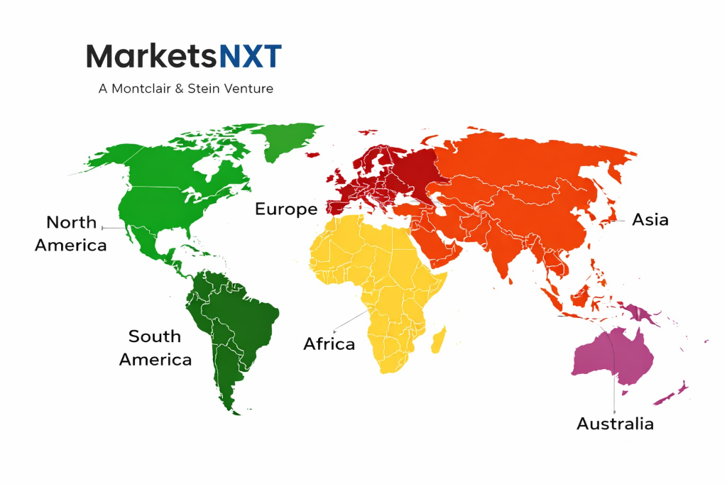
North America represents the most mature buyer base with sophisticated procurement processes and established accuracy standards, driven by extensive infrastructure renewal programs and environmental monitoring requirements. Europe demonstrates the fastest-growing demand, particularly in Nordic countries implementing digital government initiatives and smart city projects requiring comprehensive spatial data foundations. Asia Pacific shows strong procurement activity in urban development and transportation infrastructure, though buyer requirements vary significantly between developed markets like Japan and emerging economies focusing on basic mapping and surveying services.
Regional differences significantly impact procurement decisions, with European buyers prioritizing GDPR compliance and open data standards, while North American buyers focus on professional liability insurance and established quality certification systems. Middle East markets emphasize rapid delivery timelines for large-scale development projects, often requiring 24-hour survey operations and expedited data processing. Latin American buyers frequently require suppliers with local partnerships and in-country data processing capabilities due to regulatory restrictions on cross-border spatial data transfer.
Leading Market Participants
- Esri
- Trimble
- Fugro
- AECOM
- Tetra Tech
- Bentley Systems
- Hexagon
- WSP Global
- Jacobs Engineering
- Stantec
What Comes Next for Geospatial Engineering
The most significant change over the next 3-5 years will be mandatory integration of geospatial data with Building Information Modeling (BIM) systems for all major infrastructure projects, requiring suppliers to demonstrate seamless data exchange capabilities and real-time collaboration platforms. Regulatory frameworks are evolving toward standardized spatial data quality requirements and automated compliance reporting, while artificial intelligence integration will become standard for feature extraction and predictive spatial modeling. Climate resilience requirements will drive demand for advanced environmental monitoring and predictive analytics capabilities across all project types.
Buyers should begin evaluating suppliers' cloud-native platform capabilities and API integration options now, as traditional desktop-based workflows will become obsolete for collaborative projects. Establishing preferred supplier agreements with firms demonstrating strong AI and automation capabilities will be crucial for maintaining competitive project delivery timelines. Organizations should also invest in internal GIS training and spatial data management capabilities to reduce dependency on external consultants for routine spatial analysis tasks and improve their ability to evaluate supplier deliverables effectively.
Frequently Asked Questions
Market Segmentation
- Surveying and Mapping
- GIS Analysis and Consulting
- Remote Sensing Services
- Spatial Database Development
- Asset Management Solutions
- Environmental Monitoring
- Traditional Ground Surveying
- Aerial and Drone Mapping
- Satellite Imagery Analysis
- LiDAR and 3D Scanning
- Mobile Mapping Systems
- Cloud-based Platforms
- Government and Public Sector
- Transportation and Infrastructure
- Utilities and Energy
- Real Estate and Construction
- Environmental Services
- Mining and Natural Resources
- Urban Planning and Development
- Infrastructure Design and Maintenance
- Environmental Impact Assessment
- Emergency Management
- Asset Tracking and Management
- Regulatory Compliance
Table of Contents
1.1 Research Methodology / 1.2 Scope and Definitions / 1.3 Data Sources
Chapter 02 Executive Summary
2.1 Report Highlights / 2.2 Market Size and Forecast 2024-2034
Chapter 03 Geospatial Engineering and Consulting Services - Industry Analysis
3.1 Market Overview / 3.2 Market Dynamics / 3.3 Growth Drivers
3.4 Restraints / 3.5 Opportunities
Chapter 04 Service Type Insights
Chapter 05 Technology Insights
Chapter 06 End User Insights
Chapter 07 Application Insights
Chapter 08 Geospatial Engineering and Consulting Services - Regional Insights
8.1 North America / 8.2 Europe / 8.3 Asia Pacific
8.4 Latin America / 8.5 Middle East and Africa
Chapter 09 Competitive Landscape
9.1 Competitive Overview / 9.2 Market Share Analysis
9.3 Leading Market Participants
9.3.1 Esri / 9.3.2 Trimble / 9.3.3 Fugro / 9.3.4 AECOM / 9.3.5 Tetra Tech / 9.3.6 Bentley Systems / 9.3.7 Hexagon / 9.3.8 WSP Global / 9.3.9 Jacobs Engineering / 9.3.10 Stantec
9.4 Outlook
Research Framework and Methodological Approach
Information
Procurement
Information
Analysis
Market Formulation
& Validation
Overview of Our Research Process
MarketsNXT follows a structured, multi-stage research framework designed to ensure accuracy, reliability, and strategic relevance of every published study. Our methodology integrates globally accepted research standards with industry best practices in data collection, modeling, verification, and insight generation.
1. Data Acquisition Strategy
Robust data collection is the foundation of our analytical process. MarketsNXT employs a layered sourcing model.
- Company annual reports & SEC filings
- Industry association publications
- Technical journals & white papers
- Government databases (World Bank, OECD)
- Paid commercial databases
- KOL Interviews (CEOs, Marketing Heads)
- Surveys with industry participants
- Distributor & supplier discussions
- End-user feedback loops
- Questionnaires for gap analysis
Analytical Modeling and Insight Development
After collection, datasets are processed and interpreted using multiple analytical techniques to identify baseline market values, demand patterns, growth drivers, constraints, and opportunity clusters.
2. Market Estimation Techniques
MarketsNXT applies multiple estimation pathways to strengthen forecast accuracy.
Bottom-up Approach
Aggregating granular demand data from country level to derive global figures.
Top-down Approach
Breaking down the parent industry market to identify the target serviceable market.
Supply Chain Anchored Forecasting
MarketsNXT integrates value chain intelligence into its forecasting structure to ensure commercial realism and operational alignment.
Supply-Side Evaluation
Revenue and capacity estimates are developed through company financial reviews, product portfolio mapping, benchmarking of competitive positioning, and commercialization tracking.
3. Market Engineering & Validation
Market engineering involves the triangulation of data from multiple sources to minimize errors.
Extensive gathering of raw data.
Statistical regression & trend analysis.
Cross-verification with experts.
Publication of market study.
Client-Centric Research Delivery
MarketsNXT positions research delivery as a collaborative engagement rather than a static information transfer. Analysts work with clients to clarify objectives, interpret findings, and connect insights to strategic decisions.