
Terrestrial Laser Scanning Market Size, Share & Forecast 2026–2034
Report Highlights
- ✓Market Size 2024: $2.8 billion
- ✓Market Size 2034: $6.9 billion
- ✓CAGR: 9.4%
- ✓Market Definition: Terrestrial laser scanning encompasses ground-based 3D laser measurement systems that capture precise spatial data for surveying, construction, and industrial applications. These systems use time-of-flight or phase-shift technology to generate detailed point clouds for mapping and modeling purposes.
- ✓Leading Companies: Leica Geosystems, FARO Technologies, Trimble, Topcon, Riegl Laser Measurement Systems
- ✓Base Year: 2025
- ✓Forecast Period: 2026–2034
Terrestrial Laser Scanning at a Turning Point: Market Overview
The terrestrial laser scanning market stands at $2.8 billion in 2024, representing a mature yet rapidly evolving segment of the geospatial technology landscape. The market has experienced accelerated adoption across construction, mining, and infrastructure sectors, driven by increasing demands for precision measurement and digital twin applications. Recent technological advances in scanning speed, range accuracy, and data processing capabilities have expanded the addressable market beyond traditional surveying into real-time monitoring and quality control applications.
The current moment represents a critical inflection point as the convergence of artificial intelligence, cloud computing, and mobile scanning platforms transforms terrestrial laser scanning from a specialized surveying tool into an integrated digital workflow solution. This shift is fundamentally altering competitive dynamics, with traditional hardware manufacturers now competing against software-centric companies offering end-to-end scanning solutions. The integration of terrestrial scanning with Building Information Modeling (BIM) and Geographic Information Systems (GIS) has created new market segments while accelerating replacement cycles for legacy equipment.
Key Forces Shaping Terrestrial Laser Scanning Growth
Infrastructure modernization programs across developed economies represent the primary growth engine, with government initiatives in bridge inspection, highway maintenance, and urban planning driving systematic adoption of terrestrial scanning technologies. The U.S. Infrastructure Investment and Jobs Act alone allocated $550 billion for infrastructure upgrades, creating direct demand for precision measurement tools. Construction industry digitization serves as the second major force, with contractors increasingly requiring as-built documentation and progress monitoring capabilities that traditional measurement methods cannot deliver at scale.
The third critical growth driver emerges from industrial facility management requirements, where aging infrastructure demands continuous monitoring for safety compliance and operational efficiency. Manufacturing plants, chemical facilities, and power generation assets now mandate regular 3D scanning for maintenance planning and regulatory reporting. This industrial segment generates higher average selling prices than construction applications while demanding more sophisticated software integration, creating a revenue multiplier effect that extends beyond hardware sales into recurring software subscriptions and professional services.
Barriers and Risks in the Terrestrial Laser Scanning Market
High capital equipment costs remain the most significant structural barrier, with professional-grade terrestrial scanners ranging from $150,000 to $500,000, effectively limiting market penetration to larger surveying firms and construction companies. This price sensitivity creates cyclical vulnerability during economic downturns when capital equipment purchases face immediate deferral. Skills shortage represents an equally persistent challenge, as effective terrestrial scanning requires specialized technical expertise that many organizations lack internally, forcing reliance on external service providers and slowing direct adoption rates.
Cyclical risks center on construction sector volatility and infrastructure spending cycles that can dramatically impact short-term demand patterns. The rise of mobile scanning technologies and drone-based alternatives poses a longer-term structural threat, particularly for applications where terrestrial scanning's superior accuracy may not justify its cost premium. Regulatory uncertainty around data privacy and security standards for critical infrastructure scanning adds another layer of risk, particularly for government and utility sector applications that represent significant revenue concentrations.
Emerging Opportunities in Terrestrial Laser Scanning
Real-time scanning applications represent the most promising near-term opportunity, with construction companies demanding live progress monitoring and quality control capabilities that integrate directly into project management workflows. This requires terrestrial scanners to deliver data processing speeds under 30 minutes and seamless integration with existing software platforms. Historic preservation and cultural heritage documentation creates a second emerging market segment, driven by UNESCO initiatives and national heritage programs that mandate high-precision 3D recording of archaeological sites and historic structures.
Autonomous vehicle development programs offer a third opportunity vector, with automotive manufacturers and technology companies requiring detailed 3D mapping of test environments and urban infrastructure. This application demands scanning accuracy to centimeter-level precision across large geographic areas. For these opportunities to materialize, terrestrial scanning providers must demonstrate clear return-on-investment metrics, achieve software interoperability standards, and develop rental or subscription pricing models that reduce upfront capital requirements for new market entrants.
Investment Case: Bull, Bear, and What Decides It
The bull case for terrestrial laser scanning centers on accelerating digital transformation across construction and infrastructure sectors, with government infrastructure spending providing a stable demand foundation through 2030. Growing integration with artificial intelligence and machine learning platforms creates software revenue streams that generate higher margins than hardware sales while establishing recurring revenue models. Expanding applications in industrial IoT and smart city initiatives position terrestrial scanning as essential infrastructure for next-generation urban management systems.
The bear case emerges from technological substitution risks, particularly as drone-based scanning and mobile mapping systems achieve comparable accuracy at lower costs for many applications. Economic sensitivity remains pronounced, with construction sector downturns historically reducing scanner sales by 30-40% within single quarters. Intense competition from new market entrants offering cloud-based solutions threatens pricing power for established hardware manufacturers, while consolidation among surveying firms reduces the total addressable customer base.
The decisive swing variable is the speed of software integration across existing workflows. If terrestrial scanning achieves seamless integration with BIM, project management, and enterprise resource planning systems within the next 24 months, the market will capture expanding applications and premium pricing. Failure to achieve this integration will confine terrestrial scanning to specialized surveying applications, limiting growth potential and exposing the market to substitution by more accessible mobile scanning alternatives.
Market at a Glance
| Metric | Value |
|---|---|
| Market Size 2024 | $2.8 billion |
| Market Size 2034 | $6.9 billion |
| Growth Rate | 9.4% CAGR |
| Most Critical Decision Factor | Software workflow integration speed |
| Largest Region | North America |
| Competitive Structure | Consolidated hardware, fragmented services |
Regional Performance: Where Terrestrial Laser Scanning Is Growing Fastest
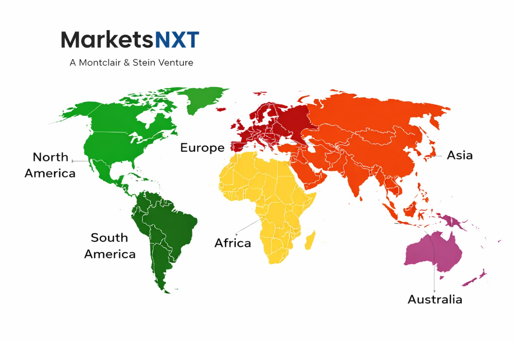
North America commands the largest revenue share at 38% of global market value, driven by extensive infrastructure renewal programs and high adoption rates in construction and mining sectors. The United States represents the single largest national market, with federal infrastructure spending and state-level bridge inspection mandates creating sustained demand growth. Europe holds 31% market share, with Germany and United Kingdom leading adoption in manufacturing and heritage preservation applications, while Scandinavian countries drive growth in forestry and environmental monitoring segments.
Asia Pacific demonstrates the highest growth rate at 12.1% CAGR, with China and Japan driving rapid expansion through smart city initiatives and industrial automation projects. China's Belt and Road infrastructure program creates substantial scanning demand across participating countries, while Japan's aging infrastructure requires extensive monitoring and documentation. Australia contributes significant mining sector demand, with iron ore and coal operations mandating regular 3D mapping for safety compliance. Latin America and Middle East markets remain smaller but show accelerating growth in oil and gas infrastructure applications, with Brazil and Saudi Arabia leading regional adoption.
Leading Market Participants
- Leica Geosystems
- FARO Technologies
- Trimble
- Topcon
- Riegl Laser Measurement Systems
- Hexagon AB
- Zoller + Fröhlich
- Teledyne Optech
- Maptek
- Surphaser
Where Is Terrestrial Laser Scanning Headed by 2034
By 2034, the terrestrial laser scanning market will reach $6.9 billion, characterized by full integration into digital construction workflows and real-time monitoring systems. The market structure will shift from hardware-centric to software-dominated revenue models, with scanning-as-a-service platforms capturing significant market share from traditional equipment sales. Scanning accuracy will achieve millimeter precision as standard, while processing speeds will enable real-time applications across construction and industrial monitoring segments.
Market concentration will increase significantly, with 3-4 major platforms controlling 70% of market share through integrated hardware-software ecosystems. Leica Geosystems and Trimble are best positioned for this future market structure, given their established software platforms and integration capabilities with existing surveying workflows. FARO Technologies faces competitive pressure unless it accelerates software development, while specialized manufacturers like Riegl will likely serve niche applications requiring extreme accuracy. The successful companies will be those that transform from equipment manufacturers into comprehensive digital workflow providers, offering subscription-based services that embed terrestrial scanning into broader enterprise software systems.
Frequently Asked Questions
Market Segmentation
- Phase-based Scanner
- Time-of-flight Scanner
- Triangulation Scanner
- Short Range (0-100m)
- Medium Range (100-1000m)
- Long Range (Above 1000m)
- Construction and Engineering
- Mining
- Oil and Gas
- Aerospace and Defense
- Forestry and Agriculture
- Cultural Heritage
- Surveying Companies
- Construction Companies
- Government Agencies
- Mining Companies
- Oil and Gas Companies
- Research Institutions
Table of Contents
Research Framework and Methodological Approach
Information
Procurement
Information
Analysis
Market Formulation
& Validation
Overview of Our Research Process
MarketsNXT follows a structured, multi-stage research framework designed to ensure accuracy, reliability, and strategic relevance of every published study. Our methodology integrates globally accepted research standards with industry best practices in data collection, modeling, verification, and insight generation.
1. Data Acquisition Strategy
Robust data collection is the foundation of our analytical process. MarketsNXT employs a layered sourcing model.
- Company annual reports & SEC filings
- Industry association publications
- Technical journals & white papers
- Government databases (World Bank, OECD)
- Paid commercial databases
- KOL Interviews (CEOs, Marketing Heads)
- Surveys with industry participants
- Distributor & supplier discussions
- End-user feedback loops
- Questionnaires for gap analysis
Analytical Modeling and Insight Development
After collection, datasets are processed and interpreted using multiple analytical techniques to identify baseline market values, demand patterns, growth drivers, constraints, and opportunity clusters.
2. Market Estimation Techniques
MarketsNXT applies multiple estimation pathways to strengthen forecast accuracy.
Bottom-up Approach
Aggregating granular demand data from country level to derive global figures.
Top-down Approach
Breaking down the parent industry market to identify the target serviceable market.
Supply Chain Anchored Forecasting
MarketsNXT integrates value chain intelligence into its forecasting structure to ensure commercial realism and operational alignment.
Supply-Side Evaluation
Revenue and capacity estimates are developed through company financial reviews, product portfolio mapping, benchmarking of competitive positioning, and commercialization tracking.
3. Market Engineering & Validation
Market engineering involves the triangulation of data from multiple sources to minimize errors.
Extensive gathering of raw data.
Statistical regression & trend analysis.
Cross-verification with experts.
Publication of market study.
Client-Centric Research Delivery
MarketsNXT positions research delivery as a collaborative engagement rather than a static information transfer. Analysts work with clients to clarify objectives, interpret findings, and connect insights to strategic decisions.