Electronic Navigational Charts Market Size, Share & Forecast 2026–2034
Report Highlights
- ✓Market Size 2024: USD 1.74 Billion
- ✓Market Size 2034: USD 3.62 Billion
- ✓CAGR: 7.6%
- ✓Market Definition: The Electronic Navigational Charts (ENC) market encompasses the production, licensing, distribution, and integration of standardized digital vector chart databases used for maritime navigation, compliant with IHO S-57 and S-100 data standards. It includes chart compilation services, ECDIS-compatible data delivery platforms, and value-added chart management software.
- ✓Leading Companies: Navionics, C-MAP (Comar Systems), AVCS (UKHO), Jeppesen (Boeing), Furuno Electric
- ✓Base Year: 2025
- ✓Forecast Period: 2026–2034
Analyst Recommendation — Prioritise S-100 Integration Now: Fleet operators and ECDIS OEMs must commit hardware upgrade budgets by Q3 2025 to avoid operational non-compliance in 2026. Vendors positioned to deliver validated S-100-compatible chart management platforms before competitors will capture the highest-margin enterprise licensing contracts in the transition window.
How the Electronic Navigational Charts Market Works: Supply Chain Explained
The ENC supply chain originates with primary hydrographic survey data collected by national hydrographic offices (NHOs) — institutions such as the UK Hydrographic Office, NOAA in the United States, and the Brazilian Navy Hydrographic Centre. These agencies deploy survey vessels equipped with multibeam echo sounders, LIDAR, and satellite altimetry systems to capture bathymetric data, coastline geometry, and seabed hazard positions. Raw survey data is then processed through specialised cartographic software — predominantly Esri-based GIS platforms or proprietary tools — and encoded into S-57 vector format, the IHO-mandated standard for ENCs. NHOs then license this compiled chart data either directly to end users or wholesale to value-added resellers (VARs) including Jeppesen, C-MAP, and Navionics, who aggregate multi-national ENC portfolios and repackage them into commercially deployable chart databases.
Finished ENC datasets reach end customers through two principal channels: direct download via government-operated distribution portals such as the AVCS (Admiralty Vector Chart Service) and commercial distribution via ECDIS manufacturers including Furuno, JRC, and Kongsberg. Pricing operates on tiered licensing structures — voyage-based licences for tramp operators, annual portfolio licences for liner shipping companies, and subscription APIs for OEM chart display integration. Margin concentrates at the VAR and ECDIS integration layer, where Jeppesen and C-MAP generate 60–70% gross margins on aggregated chart products. Logistics dependencies include satellite broadband connectivity for over-the-air chart updates on vessels, making Inmarsat and Iridium bandwidth availability a critical last-mile delivery variable.
Electronic Navigational Charts Market Dynamics
The ENC market operates under a quasi-regulated commercial structure where national hydrographic offices act simultaneously as primary data producers and indirect competitors to the commercial VARs they licence. IMO SOLAS Chapter V regulations mandate ECDIS carriage and official ENC use on vessels above 500 GT, which creates a captive commercial demand base insulated from discretionary purchasing cycles. Contract structures in the commercial shipping segment are dominated by multi-year portfolio licensing agreements negotiated between VARs and ship management companies, with pricing benchmarked against the number of chart cells required for operational route coverage. Switching costs are high because chart management software is deeply integrated into ECDIS hardware platforms.
Buyer power is moderate among large fleet operators — major tanker managers such as Stena and Euronav negotiate volume discounts directly with Jeppesen or UKHO — but negligible among smaller operators and fishing vessel fleets who accept published tariff pricing. The market exhibits significant information asymmetry: commercial VARs know precisely which chart cells a vessel has licensed and when those licences expire, giving them structural renewal leverage. Commoditisation is advancing at the standard chart level, driving VARs to differentiate through ancillary data layers — tidal stream predictions, AIS-integrated hazard overlays, and dynamic depth contours — that command premium pricing above baseline ENC licences.
Growth Drivers Fuelling Electronic Navigational Charts Expansion
The primary growth driver is mandatory ECDIS adoption cascading through vessel categories not previously covered by SOLAS requirements. Flag state administrations across Southeast Asia and West Africa are progressively extending carriage requirements to smaller commercial vessels — fishing fleets, coastal passenger ferries, and offshore support vessels — that collectively represent hundreds of thousands of new ENC licence units. This driver translates directly into expanded demand for shallow-water and coastal chart cells, which are compiled by regional NHOs in countries including Indonesia, Nigeria, and Vietnam, placing pressure on those offices to accelerate survey coverage and data encoding capacity.
The second major driver is the autonomous and semi-autonomous vessel development pipeline. Autonomous surface vessels (ASVs) operated by companies including Kongsberg Maritime and Sea-Kit International require continuously updated, machine-readable ENC data feeds with sub-metre positional accuracy — specifications that exceed current S-57 standard capabilities and are driving early adoption of S-100 high-resolution chart products. A third driver is port and terminal digitisation: smart port initiatives across Rotterdam, Singapore, and Busan are integrating ENC data into vessel traffic management systems and berth planning algorithms, creating institutional demand for enterprise ENC data licences at the port authority level rather than purely vessel-side demand.
Supply Chain Risks and Market Restraints
The most acute supply chain risk is geographic concentration of hydrographic survey capacity. Globally, fewer than 30 nations operate deep-water survey vessels capable of producing IHO-compliant ENC source data. In critical high-traffic corridors — the Strait of Malacca, Torres Strait, and Gulf of Aden — chart cell update frequencies lag actual seabed change rates by 5–15 years, creating documented safety gaps that also constrain the commercial ENC market by limiting the saleable chart cell count in those regions. NHOs in developing nations lack capital to deploy modern survey equipment, creating a structural data scarcity that no commercial entity has a commercial incentive to resolve independently.
A second material restraint is the slow pace of S-100 standard adoption across the ECDIS hardware installed base. The S-100 transition requires not only software updates but, in many legacy ECDIS units manufactured before 2018, full hardware replacement — a capital expenditure that ship operators are deferring. This delay compresses revenue opportunity for VARs who have invested in S-100 product development and slows retirement of the legacy S-57 product revenue base. Regulatory trade barriers also affect the market: China's domestic ENC requirements mandate use of CNHO-issued charts in Chinese territorial waters, effectively excluding UKHO AVCS products and limiting international VAR revenues from the world's largest shipping nation.
Where Electronic Navigational Charts Growth Opportunities Are Emerging
The highest-value near-term opportunity lies in S-100 product development for the commercial shipping segment. VARs that deliver validated, ECDIS-certified S-100 chart portfolios before the 2026 IMO implementation milestone will capture multi-year enterprise licences from fleet operators who cannot afford operational delays during the transition. This opportunity concentrates value at the chart compilation and certification layer of the supply chain — specifically the software vendors capable of ingesting raw NHO S-100 source data and packaging it into tested, ECDIS OEM-compatible distributions. Jeppesen and C-MAP have existing infrastructure advantages here, but smaller vendors including Teledyne CARIS are aggressively building S-100 compilation workflows.
A second emerging opportunity is Arctic route ENC development. As summer ice extent declines, the Northern Sea Route and Northwest Passage are attracting commercial bulk carrier and LNG tanker transits, but ENC coverage of Arctic waters remains critically sparse — the Russian Arctic coast and Canadian archipelago have less than 30% modern IHO-standard coverage. Operators willing to commission private hydrographic surveys and develop proprietary Arctic ENCs — a model already piloted by Equinor for Norwegian offshore Arctic operations — can capture premium chart licensing fees from the growing pool of vessels transiting these corridors under compulsory pilotage. Value capture concentrates at the survey-to-chart compilation node, where proprietary bathymetric data creates durable competitive moats.
Market at a Glance
| Metric | Detail |
|---|---|
| Market Size 2024 | USD 1.74 Billion |
| Market Size 2034 | USD 3.62 Billion |
| Growth Rate (CAGR) | 7.6% |
| Most Critical Decision Factor | IMO SOLAS ECDIS carriage compliance and S-100 upgrade readiness |
| Largest Region | Europe |
| Competitive Structure | Oligopoly with regulated NHO data layer and commercial VAR overlay |
Regional Supply and Demand Map
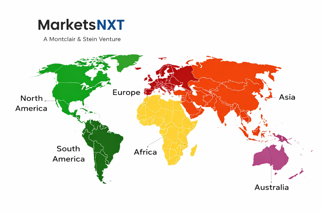
Europe dominates ENC supply, anchored by the UK Hydrographic Office in Taunton, which licenses the world's largest ENC portfolio through AVCS — covering over 14,000 cells across all global ocean regions. Norway's Kartverket and Denmark's Danish Geodata Agency are significant Arctic and North Sea cell producers. The US NOAA Office of Coast Survey produces and freely distributes ENCs for American waters under a no-charge policy that has effectively set a pricing ceiling in Western Atlantic routes. Japan's Japan Hydrographic Association and Australia's AHS contribute substantial Indo-Pacific cell volumes. Combined, Europe and North America account for over 60% of global ENC cell production by volume.
Demand is concentrated in Asia Pacific, which represents the world's largest ship registry and trading fleet base — China, South Korea, Japan, and Singapore collectively account for over 45% of global commercial vessel ECDIS installations. Despite high demand, the region is a net ENC importer, with Asian fleet operators primarily licensing chart portfolios from UKHO AVCS, C-MAP, and Jeppesen rather than regional NHOs. This creates a persistent trade flow from European and American data producers to Asian end users, mediated through commercial VAR distribution networks. The imbalance drives pricing tension: Asian fleet operators advocate for regional pricing tiers, while European NHOs defend uniform global licence tariffs to protect revenue adequacy for ongoing survey programmes.
Leading Market Participants
- Navionics (Garmin)
- C-MAP (Comar Systems)
- Jeppesen (Boeing)
- UK Hydrographic Office (UKHO)
- Furuno Electric Co., Ltd.
- Kongsberg Maritime
- Teledyne CARIS
- Japan Hydrographic Association
- NOAA Office of Coast Survey
- ChartWorld International
Long-Term Electronic Navigational Charts Outlook
By 2034, the ENC supply chain will be structurally reorganised around the S-100 data framework, which enables multi-layered, high-resolution marine geospatial data products far beyond the bathymetric and hazard data captured in S-57 charts. NHOs that invest in continuous autonomous survey programmes — deploying USV fleets for coastal and shelf-edge data capture — will produce chart cell update cycles of weeks rather than years, transforming ENC products from static licensed databases into dynamic, subscription-streamed data services. This shift will erode traditional voyage-based licence revenue and reward platform vendors with robust API delivery infrastructure and real-time data validation capabilities.
The supply chain positions of highest value in 2034 will be proprietary bathymetric data ownership in strategically important but poorly surveyed regions, and certified S-100 data integration platforms embedded into autonomous vessel navigation systems. Kongsberg Maritime is best positioned to capture the autonomous vessel segment, given its integrated ECDIS, sensor fusion, and route optimisation software stack. UKHO retains structural advantage through its unmatched global cell portfolio and existing AVCS distribution infrastructure. Jeppesen's Boeing parentage provides capital depth to build S-100 compilation capacity at scale. The greatest disruption risk is a Chinese national champion — likely CNHO or a state-backed aggregator — building an alternative global ENC distribution network that bypasses Western VAR infrastructure for Asian-flagged fleets.
Frequently Asked Questions
Market Segmentation
- Official ENCs (SOLAS-compliant, NHO-issued)
- Private ENCs (VAR-compiled, non-SOLAS)
- Recreational Digital Charts
- Inland Waterway ENCs
- Bathymetric ENCs (S-102)
- S-100 Next-Generation Charts
- Commercial Shipping (Bulk, Tanker, Container)
- Naval and Coast Guard Vessels
- Offshore Energy Support Vessels
- Recreational and Leisure Craft
- Fishing Fleets
- Port and VTS Authorities
- National Hydrographic Office Direct
- Value-Added Resellers (VARs)
- ECDIS OEM Bundled Licensing
- Cloud-Based Subscription Platforms
- Satellite Broadband Over-the-Air Delivery
- IHO S-57 (Current Standard)
- IHO S-100 (Next Generation)
- S-102 Bathymetric Surface
- S-111 Surface Currents
Table of Contents
Research Framework and Methodological Approach
Information
Procurement
Information
Analysis
Market Formulation
& Validation
Overview of Our Research Process
MarketsNXT follows a structured, multi-stage research framework designed to ensure accuracy, reliability, and strategic relevance of every published study. Our methodology integrates globally accepted research standards with industry best practices in data collection, modeling, verification, and insight generation.
1. Data Acquisition Strategy
Robust data collection is the foundation of our analytical process. MarketsNXT employs a layered sourcing model.
- Company annual reports & SEC filings
- Industry association publications
- Technical journals & white papers
- Government databases (World Bank, OECD)
- Paid commercial databases
- KOL Interviews (CEOs, Marketing Heads)
- Surveys with industry participants
- Distributor & supplier discussions
- End-user feedback loops
- Questionnaires for gap analysis
Analytical Modeling and Insight Development
After collection, datasets are processed and interpreted using multiple analytical techniques to identify baseline market values, demand patterns, growth drivers, constraints, and opportunity clusters.
2. Market Estimation Techniques
MarketsNXT applies multiple estimation pathways to strengthen forecast accuracy.
Bottom-up Approach
Aggregating granular demand data from country level to derive global figures.
Top-down Approach
Breaking down the parent industry market to identify the target serviceable market.
Supply Chain Anchored Forecasting
MarketsNXT integrates value chain intelligence into its forecasting structure to ensure commercial realism and operational alignment.
Supply-Side Evaluation
Revenue and capacity estimates are developed through company financial reviews, product portfolio mapping, benchmarking of competitive positioning, and commercialization tracking.
3. Market Engineering & Validation
Market engineering involves the triangulation of data from multiple sources to minimize errors.
Extensive gathering of raw data.
Statistical regression & trend analysis.
Cross-verification with experts.
Publication of market study.
Client-Centric Research Delivery
MarketsNXT positions research delivery as a collaborative engagement rather than a static information transfer. Analysts work with clients to clarify objectives, interpret findings, and connect insights to strategic decisions.